
Laser Profiler
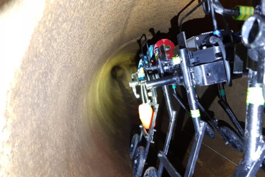
Multi Sensor Inspection Unit
Laser profiling enables extremely accurate pipeline measurements to analyse ovality, alignment, diameter and capacity
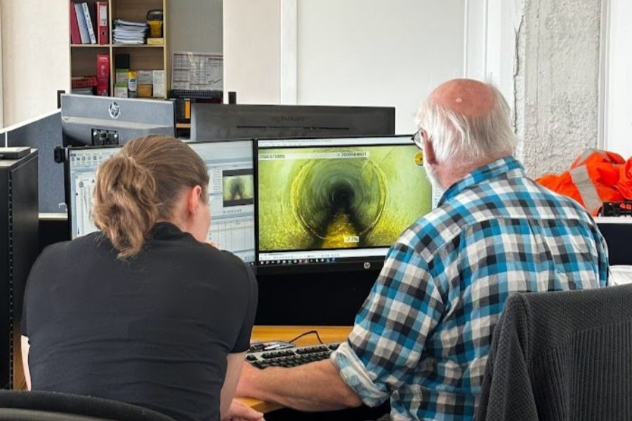
Designed to capture high-precision pipeline data and remove the need for confined space entry in hazardous environments, the profiler is mounted to our CCTV equipment and the resulting data is processed using IKAS software to deliver high-resolution insights. These inspections support asset management, defect identification, and remediation planning.
Our robotic laser profiling systems promote safety, accuracy and productivity by:
- Delivering high-precision pipeline data – captures ovality, alignment, diameter, and capacity with millimetre-level accuracy.
- Reducing confined space entry – remote-operated profiling keeps personnel out of hazardous environments.
- Supporting asset management and planning – integrates with GIS and IKAS software for actionable insights.
- Combining with multi-sensor platforms – enables sonar, laser, and CCTV data collection in a single pass.
- Improving inspection efficiency – faster data capture and processing compared to manual methods.
Our services are compliant with the New Zealand Gravity Pipe Inspection Manual (4th Edition) and trusted by councils and infrastructure operators nationwide.
Use cases
The laser profiler helps customers tackle complex pipeline inspection and condition assessment challenges safely and efficiently. Typical scenarios include:
- Assessing stormwater and wastewater pipelines – captures ovality, alignment, diameter, and capacity to evaluate structural integrity and serviceability.
- Inspecting high-flow or large-volume sewer assets – ideal for long-range inspections using multi-sensor units with laser, sonar, and CCTV.
- Reducing confined space entry risks – remote-operated profiling eliminates the need for personnel to enter hazardous environments.
- Supporting emergency response inspections – deployed rapidly to assess damage or blockage in critical infrastructure.
- Providing actionable data for asset lifecycle planning – integrates with GIS and IKAS software to inform maintenance and rehabilitation strategies.
- Delivering high-resolution visuals for complex conditions – processed by interactive viewers to clearly display defects, deformation, and joint issues.
- Combining drones and LiDAR – for confined space or inaccessible areas, laser profiling complements drone-based inspections for full 3D mapping.